

Hurricane Genevieve and Tropical Cyclone Higos
Eastern Pacific:
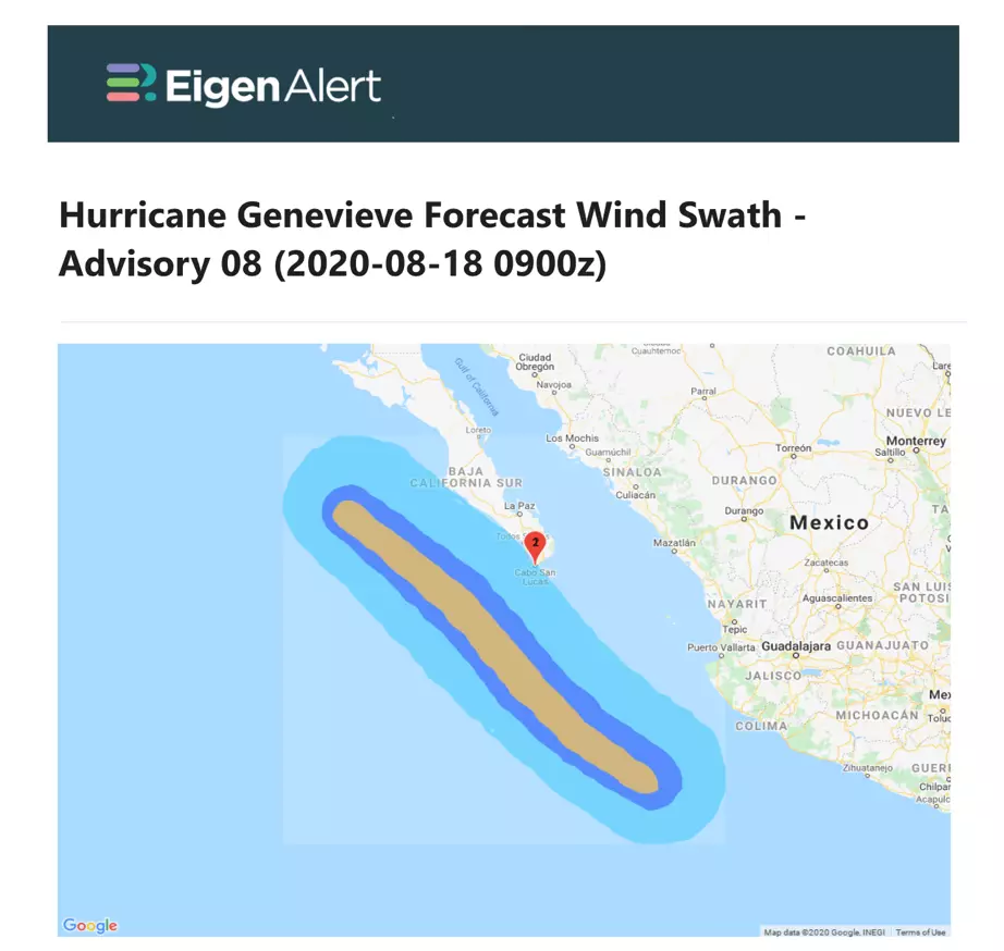
Hurricane Genevieve is rapidly intensifying this morning, and is currently a category 3 hurricane according to the National Hurricane Center forecast discussion. Genevieve is expected to continue on a northwesterly track, offshore of the west coast of Mexico.
Hurricane Genevieve is expected to pass near or south-west of the southern tip of the Baja California peninsula on Wednesday, where a tropical storm warning is in effect. Strong swells will impact the Pacific coast of Mexico today and tomorrow.
South China Sea:
Tropical cyclone Higos is moving northwest across the South China Sea towards Guangdong province in southern China, and is expected to pass south of Hong Kong as a tropical depression.
Strengthening is expected as Higos moves west-northwest towards landfall tomorrow in Guangdong at tropical storm strength.
Follow the quick links to assess the impact in EigenPrism:
- Hurricane Genevieve 2020 5-day forecast max winds – as of August 18, 2020
- Tropical Storm Higos Forecast Wind Swath – as of August 18, 2020
- Hurricane force wind probabilities – as of August 18, 2020
- Tropical storm force wind probabilities – as of August 18, 2020
Don’t have access to EigenPrism?
Sign up for a trial account and access full impact reports of all events. Contact us and we’ll set up a trial account for you.
More on event news:
- TROPICAL STORM ELIDA
- TYPHOON JANGMI
- TYPHOON MEKKHALA
- M 5.1 EARTHQUAKE NORTH CAROLINA
- ISAIAS POST-EVENT IMPACT SUMMARY
- ISAIAS LANDFALL IN NORTH CAROLINA
- COVID-19 FORECAST– (COVID-19 data now available monthly.)


