

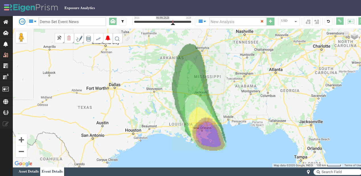
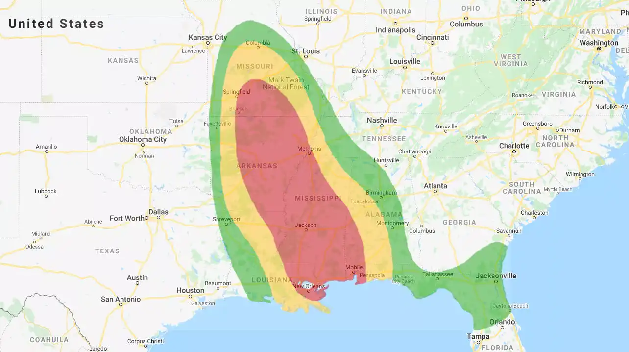
Tropical depression Cristobal
Tropical Storm Cristobal made landfall in Louisiana Sunday afternoon. Now a tropical depression, the remnants of Cristobal will bring heavy rain and gusty winds into the upper midwest as it moves inland.
The image above shows the excessive rainfall outlook, while the image below shows the probability of winds exceeding 34 knots per hour (tropical storm force winds).
Assessing the impact
Selected Cristobal Quick Links:
- Tropical-storm-force wind probabilities – as of 06-08-2020
- Past wind swath – as of 06-08-2020, Advisory #28
- Storm surge potential – as of 06-08-2020, Advisory #27
- WPC Day 1 Excessive Rainfall Outlook – as of 06-08-2020
- 3-Day Flood Potential – as of 06-08-2020
Impact Summary Report:
To view all Tropical Storm Cristobal event footprints in the impact summary report, open the ‘SAMPLE Cristobal 2020 Forecast Impact Summary’ (updated to include latest wind and rainfall outlooks as well as the Storm Surge Potential footprint).
You can also search for “SAMPLE Cristobal 2020 Forecast Impact Summary” on the EigenPrism home page, then click Manage > Copy to select your workspace and save with your own exposure.
Please note, as report templates are frequently updated, you can refresh the report by changing the Analysis Date. See instructions here.
Turn weather forecasts into actionable insights with EigenPrism.
Automated notifications deliver key metrics showing the potential impact on your exposure – number of locations and TIV at risk, plus estimated Ground Up Loss and Gross Loss.
EigenAlerts provide automated notifications via email and text message with key metrics to estimate impact:
- Customized and mobile-enabled
- Updated as forecasts and advisories change
Not a subscriber, but want to see how this works? Contact us for your free trial; and we’ll show you how EigenPrism helps you plan, monitor, and respond to nat cat events.


