

Bighorn wildfire causes residents to evacuate.
The Bighorn wildfire in the Santa Catalina Mountains near Tucson, has destroyed over 4700 acres of land and forced to issue mandatory evacuations for about 200 residences. The wildfire was caused by lightning, when a severe storm passed through Arizona last week.
The wildfire zone has temperatures up to 106 degrees and continued low humidity. Wildfires throughout the state have been fueled by the hot weather conditions and this might increase the wildfire activity.
Turn forecasts into actionable insights with EigenPrism.
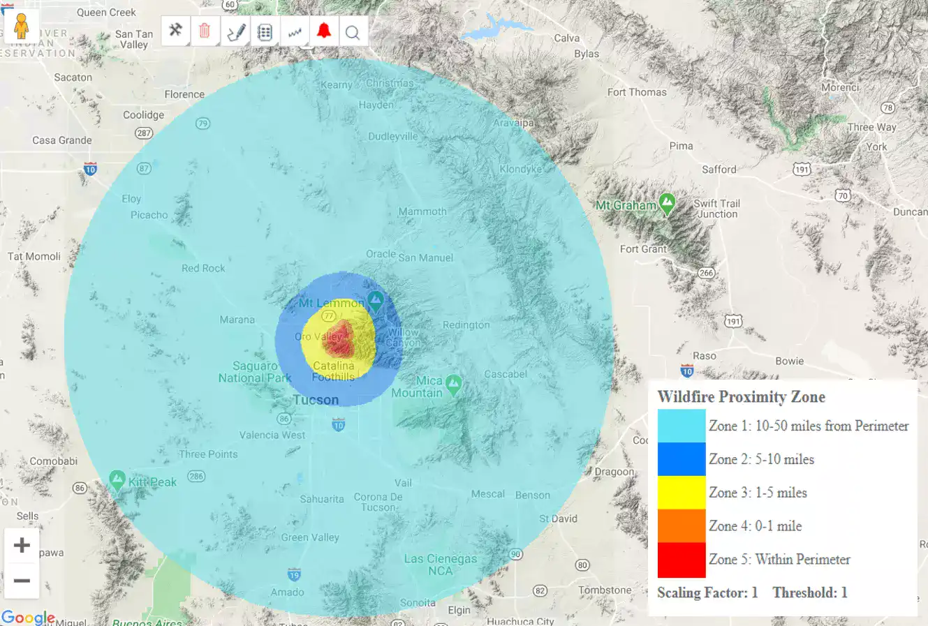
AZ Bighorn Wildfire Proximity Map – as of 06-12-2020
Wildfire proximity maps show proximity of locations at risk to the active wildfire in terms of distance from the current fire perimeter. Distance from perimeter is provided in zones:
- Zone 1: 10-50 miles
- Zone 2: 5-10 miles
- Zone 3: 1-5 miles
- Zone 4: 0-1 miles
- Zone 5: Within perimeter
The state wildfire proximity map provides a view of the proximity maps for all wildfires within Arizona:
Arizona State Wildfire Proximity Map – as of 06-12-2020
Automated notifications deliver key metrics showing the potential impact on your exposure – including number of locations and TIV at risk, plus estimated Ground Up Loss.
EigenAlerts provide automated notifications via email and text message with key metrics to estimate impact:
- Customized and mobile-enabled
- Updated as forecasts and advisories change
Not a subscriber, but want to see how this works? Contact us for your free trial; and we’ll show you how EigenPrism helps you plan, monitor, and respond to nat cat events.


