

Tropical Storm Sally threatens Louisiana coast
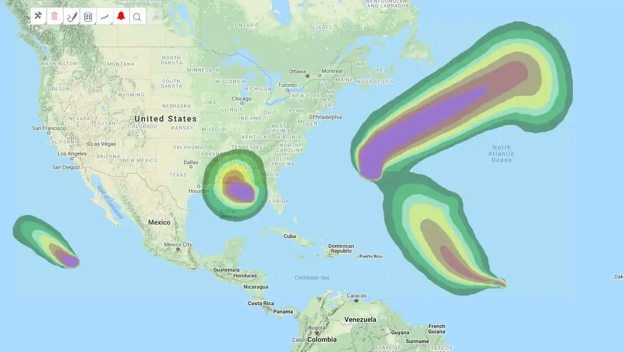
Tropical storm Sally is expected to reach category 1 hurricane status when it makes landfall on the Louisiana coast Monday night, while Hurricane Paulette is moving northeast after making landfall on Bermuda.

Sally is a slow moving storm and is expected to produce significant storm surge and heavy rainfall. Landfall is forecast to the east of New Orleans but large sections of the coast may be impacted, including areas still recovering from Hurricane Laura.
In addition to wind probabilities and forecast wind swaths, storm surge potential outlooks, precipitation-based flood potential outlooks and excessive rainfall outlooks are available in EigenPrism, giving you a complete picture of how Sally may impact insured locations.
Key quick links are shown below, and a template Impact Summary report has been created.
Assess the impact in EigenPrism:
Quick Links:
- Tropical storm force wind probabilities – as of September 14, 2020
- Hurricane force wind probabilities – as of September 14, 2020
- Tropical Storm Sally forecast wind swath – Advisory 12, September 14, 2020
- Tropical Storm Sally storm surge potential outlook – Advisory 11, September 14, 2020
Impact Summary Report:
An impact summary template report is now available; SAMPLE Sally 2020 Impact Summary. EigenPrism users can copy the template report and apply it to their own exposure:
- Open the impact summary report (see link above)
- or, search for the “SAMPLE storm name Impact Summary” on the EigenPrism home page
- then click Manage > Copy to select your workspace and save with your own exposure
Please note, as report templates are frequently updated, you can refresh the report by changing the Analysis Date. See instructions here.
Don’t have access to EigenPrism?
Sign up for a trial account and access full impact reports of all events. Contact us and we’ll set up a trial account for you.


