

Typhoon Goni to make landfall over the weekend in the Philippines
Storm Activity: 10/30/2020, Friday
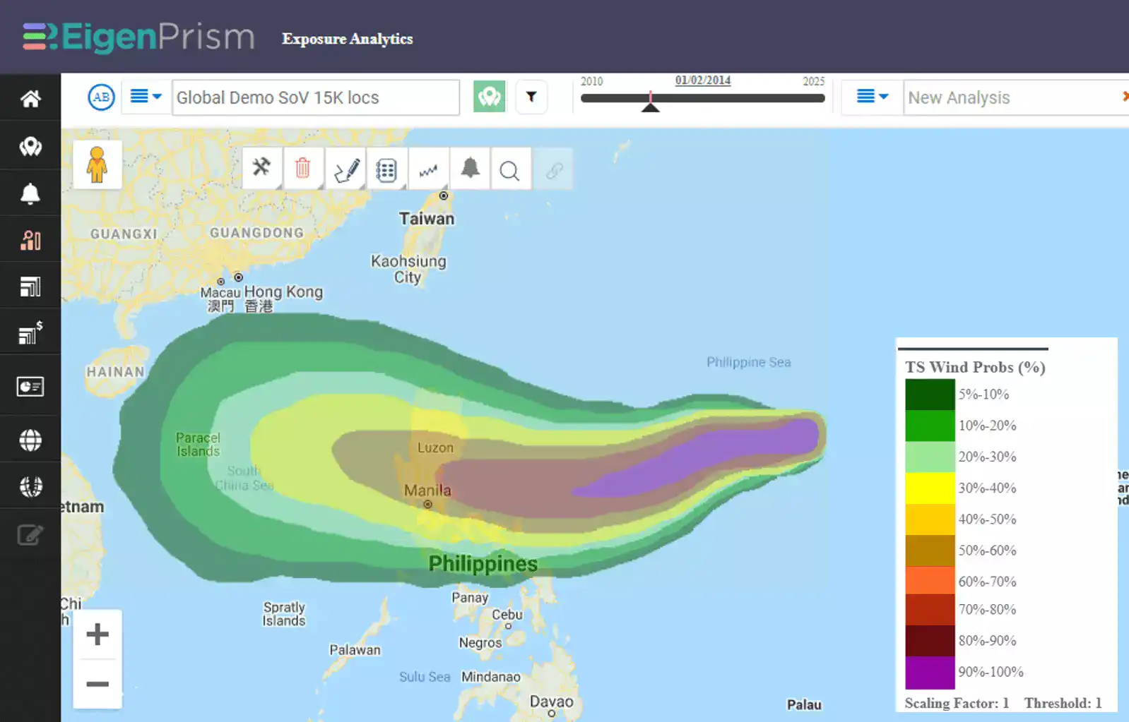
A tropical depression formed on Wednesday near the Philippines, rapidly intensified into Tropical Storm Goni, and then became a category 4 Typhoon within 24 hours. As of now, Typhoon Goni continues to move west-north-westward with maximum sustained winds of 145 m/h.
Goni is predicted to intensify further over the weekend while moving over the Philippine Sea. The landfall may occur on Sunday, November 1 around the Quezon-Aurora area.
Goni will be given the local name Rolly when it enters PAR (Philippines area of responsibility) and will be the 18th tropical cyclone in this region.
Another tropical depression has developed this morning outside PAR and is predicted to enter PAR on November 2 or November 3. When it enters PAR, it will be given the local name Siony.
Follow the quick links to assess the impact in EigenPrism:
- Tropical Storm Goni 5-day Forecast Max Winds – as of 2020-10-29
- Hurricane-Force Wind Probabilities – from 2020-10-29 to 2020-11-03
- Tropical-Storm-Force Wind Probabilities – from 2020-10-29 to 2020-11-03
- Typhoon Goni Forecast Wind Swath (Advisory 09) – as of 2020-10-30
Don’t have access to EigenPrism?
Sign up for a trial account and access full impact reports of all events. Contact us and we’ll set up a trial account for you.


