

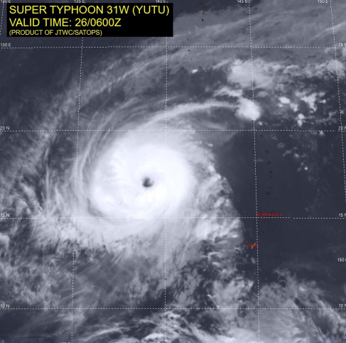
Super Typhoon Yutu
Super Typhoon Yutu, the strongest tropical cyclone of 2018 to date, is moving north-west through the Pacific Ocean after passing over the Northern Mariana Islands, where the islands of Saipan and Tinian were severely impacted.
The U.S. Joint Typhoon Warning Center reports that Yutu has maximum sustained winds of category 5 intensity. It is moving towards south-east Asia, and could impact the Philippines, Taiwan or southern Japan next week. The forecast track is uncertain, and the storm could still turn north-east, away from land. Some weakening is expected as it moves closer to land in the coming days.
Update – October 26
Yutu remains a well-organized typhoon in a favorable environment, continuing on the forecast westward track. Slight weakening is expected in the next 72-hours.
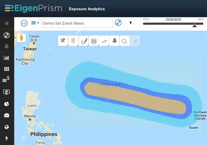
Assessing the impact
Due to the size and current intensity of Super Typhoon Yutu, a forecast Impact Summary report template (containing the relevant real-time event footprints) has been provided to all EigenPrism subscribers. We recommend frequent updating of this report as the storm advances closer to south-east Asia.
EigenAlerts provide automated notifications with key metrics to estimate impact:
- Customized and mobile enabled
- Updated as forecasts and advisories change
Subscribers who set hurricane, flood and rainfall Alerts will continue to receive automated impact estimates via text and email. Please just click here to email us if you need help setting Alerts, or with further event analysis.
Contact us if you want to use EigenAlerts immediately; you can be up and running in a day if you have data in standard cat model or spreadsheet format.
Arrange a live demo
Not a subscriber, but want to see how this works? Contact us and we’ll set up a live demo to show you how EigenPrism helps you plan, monitor and respond to nat cat events.
[wpforms id=”2114″]


