

Southern California Wildfires Impact Analysis
As the Southern California wildfires continue to develop, insurers, brokers and risk managers are focused on assessing the impact to their exposed properties.
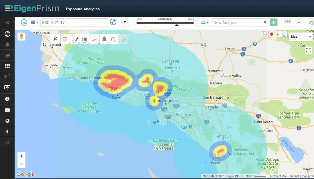
To aid in the impact analysis, wildfire proximity maps can be used to determine how close a given location is to the current fire perimeter. EigenPrism’s real-time event set for wildfire proximity maps is being updated daily to reflect the Southern California wildfires.
- For real-time updates, we recommend setting a wildfire Alert. This will provide automated notifications, with key impact metrics, as soon as the event set is updated. Alerts can be delivered by text message as well as by email, and are available in our App.
- Wildfire Impact Analysis Reports provide summary details for your top 20 exposures, and a template is available that will ensure the most recent event set is used when the report is generated.
Real-time data for Southern California Wildfires:
We recommend subscribers set an Alert on the real time event set “Fire Forecast: Proximity Map for Active US Wildfires”.
This will ensure you will be Alerted for any location within 1, 2, 5, 10, 50 miles of the fire.
Subscribers can visualize the fire location relative to insured exposures.
![]()


