

Santa Rosa Wildfire Event Impact Analysis
Santa Rosa Wildfire
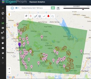
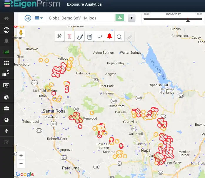
To assist with event impact analysis for the Santa Rosa wildfire, fire detection data is now available as a Web Map Services (WMS) layer in EigenPrism.
- This layer displays information on fire locations from Moderate Resolution Imaging Spectroradiometer (MODIS) fire detection data
- Visualize the data relative to insured exposures for immediate insights
- Use the polygon function to view and assess which assets are located closest to the fire detection data
Wildfire Event Alerts
We recommend users set an Alert on the real time event set “Fire Forecast: Proximity Map for Active US Wildfires.
This will ensure you will be Alerted for any location within 1, 2, 5, 10, 50 miles of the fire.
Subscribers can visualize the fire location relative to insured exposures.
![]()


