

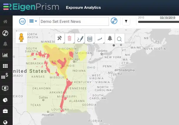
Nebraska flood outlook
The record-breaking Nebraska flood last week continues to threaten large areas of the state, and the National Weather Service’s flood outlook shows the extent of potential flooding, from Minnesota to New Orleans.
The Nebraska flood has been severe due to significant flooding on the Platte, Missouri and Elkhorn Rivers. Satellite images captured by NASA’s Earth Observatory demonstrate the impact to Offutt Air Force Base on the Missouri River:
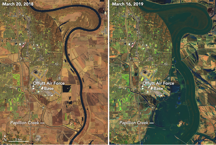
According to NASA Earth Observatory,
A rare confluence of circumstances produced the flooding. Extreme cold earlier in the winter set the stage by preserving a significant amount of snow; it also created a thick layer of ice on waterways and made the ground less permeable than usual. When an intense storm brought downpours and unusually warm air to the region in March, it rapidly melted much of the snow and ice, producing enormous runoff in a short period. As river ice broke up, large chunks compounded the problem by slamming into dams, raking against levees and other infrastructure, and packing together to jam waterways even more.
Assessing the impact
EigenAlerts provide automated notifications with key metrics to estimate impact:
- Customized and mobile enabled
- Updated as forecasts and advisories change
Subscribers who have set Alerts will receive email and text notifications detailing the estimated impact on their exposure.
Contact us if you want to use EigenAlerts immediately; you can be up and running in a day if you have data in standard cat model or spreadsheet format.
Arrange a live demo
Not a subscriber, but want to see how this works? Contact us and we’ll set up a live demo to show you how EigenPrism helps you plan, monitor and respond to nat cat events.
[wpforms id=”2114″]


