

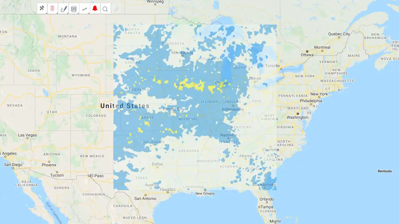
Midwest Derecho Max Wind Footprint
Our data partner, Meteorological Connections (MetCon), has created a max wind footprint for the August 10 Midwest Derecho. The footprint quick link and link to the sample report template are provided below for EigenPrism users.
MetCon also provided the following commentary regarding the Midwest Derecho:
On the morning of 10 Aug 2020, a line of storms developed in eastern Nebraska eventually intensifying and traveling nearly 800 miles before weakening in eastern Indiana. This line of storms, also known as a derecho, was associated with 70+ mph sustained winds and gusts up to 112 mph. While we will not know the true extent of the damage for at least a few days, there have been anecdotal reports of “entire counties” of row crops being destroyed. This leads us to believe that the derecho that had taken place was a high-end event, and will be one of the more memorable Derechos of the past decade.
Judson Buescher & Ashley Ballard, Meteorologist & Geospatial Analyst, MetCon, August 11, 2020
Our analysis shows that the storm started in the early morning, and was relatively disorganized, in southeastern South Dakota and northeastern Nebraska before moving into western Iowa around 10 a.m. local time. The derecho ripped through Iowa during the early afternoon leaving devastating damage in its wake. It reached its peak in eastern Iowa where multiple wind gusts greater than 105 mph were recorded alongside sustained winds of near 75 mph. Linn County, Iowa recorded the highest verifiable wind gust at 112 mph at 1 p.m. Over the next 30 minutes the derecho made its way into Illinois where sustained winds dropped by about 10 mph and gusts dropped below 100 mph. The storm reached Chicago by about 4 p.m. where 73 mph gusts were recorded. By the time the derecho reached central Indiana, it had lost most of its steam. The line broke into individual storm clusters, where some clusters saw gusts reach 60 mph, but the storm system as a whole was no longer associated with similar winds.
A few fast facts about Derechos:
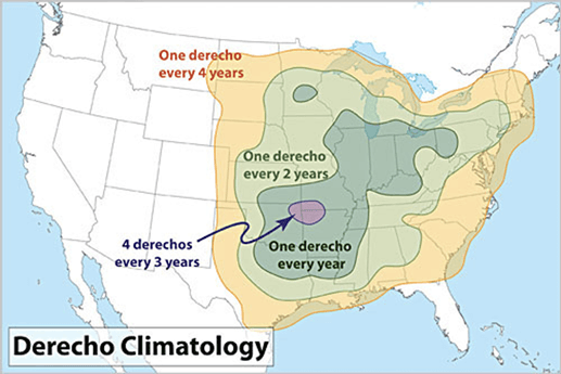
- Derechos are most common in the late spring and summer (May through August), with more than 75% occurring between April and August.
- While derecho winds typically are less than 100 mph, gusts as high as 130 mph have been recorded (May 1998) — equivalent to those with strong EF2 tornadoes.
- The winds associated with Derechos are not constant and may vary considerably along the derecho path, the swaths of stronger winds within the general path of a derecho are produced by events known as downbursts, these downbursts often occur in irregularly-arranged clusters of thunderstorms.
Follow the quick links to assess the impact in EigenPrism:
The Midwest Derecho Max Wind Footprint is now available to all users in EIgenPrism.
- 2020 Aug 10 Midwest Derecho Max Wind Footprint – as of 2020-08-11
A SAMPLE report template containing the max wind footprint has also been created. EigenPrism users can copy the template report and apply it to their own exposure:
- Open the impact summary report – SAMPLE US Midwest 2020 Derecho Event
- or, search for the “SAMPLE US Midwest 2020 Derecho Event” on the EigenPrism home page
- then click Manage > Copy to select your workspace and save with your own exposure
Please note, as report templates are frequently updated, you can refresh the report by changing the Analysis Date. See instructions here.
Don’t have access to EigenPrism?
Sign up for a trial account and access full impact reports of all events. Contact us and we’ll set up a trial account for you.
More on event news:
- MIDWEST DERECHO
- TS ELIDA
- TYPHOON JANGMI
- TYPHOON MEKKHALA
- M 5.1 EARTHQUAKE NORTH CAROLINA
- ISAIAS POST-EVENT IMPACT SUMMARY
- ISAIAS LANDFALL IN NORTH CAROLINA
- COVID-19 FORECAST– (COVID-19 data now available monthly.)


