

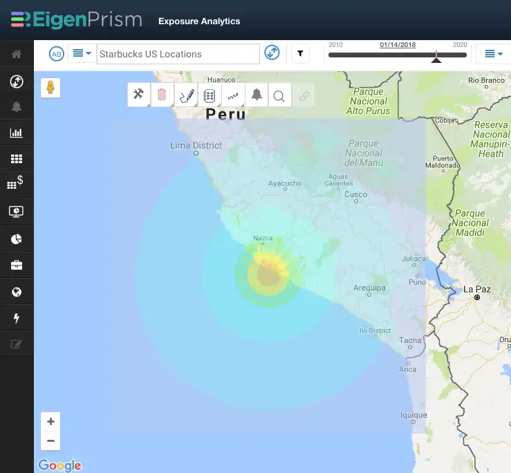
M 7.1 Earthquake in Peru
A large M 7.1 earthquake off the coast of southern Peru triggered tsunami warnings, which have since been cancelled. According to the USGS;
- Today’s earthquake was caused by shallow thrust faulting in the boundary region between the South America plate and the subducting Nazca plate
- This region has experienced 13 earthquakes greater than M 6.5, in the last 100 years
EigenPrism subscribers should check their emails for the Quick Link to this event, and as always, please contact us if you need help setting Alerts, or with further event analysis.
USGS – tectonic summary
The USGS tectonic summary for this region states that the plate boundary region between the Nazca and South America plates experiences a large number of earthquakes. The region within 250 km of the epicenter of today’s M 7.1 earthquake has experienced 13 previous earthquakes of M 6.5+ over the preceding century:
- M 8.4 June 23, 2001 – occurred along the plate boundary 130 km to the southeast (and ruptured from there ~ 200 km to the southeast). It resulted in at least 74 fatalities and destroyed more than 17,000 homes.
- M 7.7 November 12, 1996 – epicenter was about 130 km to the northwest of today’s earthquake. That event ruptured much of the megathrust between its epicenter and the epicenter of the January 14, 2018 earthquake, and resulted in at least 14 fatalities and left 12,000 people homeless.
- M 7.1 September 25, 2013 – occurred 25 km to the southeast of today’s event, and is not known to have caused any fatalities.


