

Hurricane Marco leading Tropical Storm Laura towards Gulf coast landfall
Hurricane Marco is forecast to bring hurricane conditions, with heavy rainfall and storm surge, along portions of the Gulf coast on Monday. Marco will be followed by Tropical Storm Laura, which is expected to bring additional wind, rain and storm surge impacts to the same region by mid-week.
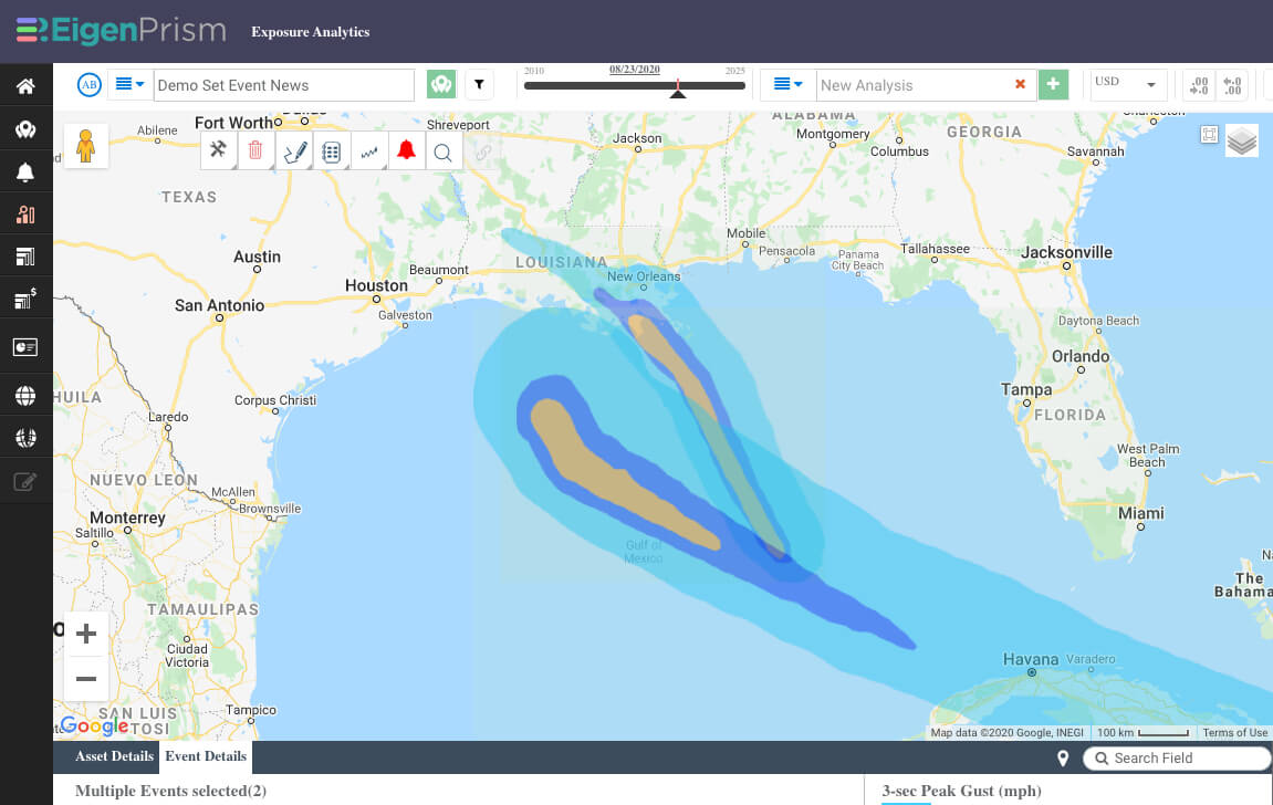
It is highly unusual for two storms to make landfall in the same region in rapid succession. The map showing tropical storm force wind probabilities (above) demonstrates how the two wind fields are moving together, while the forecast wind swaths for both storms (below) shows the expected tracks impacting the New Orleans to Galveston section of the Gulf Coast (Marco is the upper right track, while Laura is the lower left track):
In addition to wind probabilities and forecast wind swaths, storm surge potential outlooks, precipitation-based flood potential outlooks and excessive rainfall outlooks are available in EigenPrism, giving you a complete picture of how these storms may impact insured locations.
Quick links for key wind footprints are shown below, and a template Impact Summary report for each storm has been created.
Assess the impact in EigenPrism:
Quick Links:
- Hurricane force wind probabilities – as of August 23, 2020
- Tropical storm force wind probabilities – as of August 23, 2020
- Hurricane Marco forecast wind swath – Advisory 13A, August 23, 2020
- Tropical Storm Laura forecast wind swath – Advisory 15A, August 23, 2020
- Hurricane Marco 5-day forecast max winds – as of August 23, 2020
- Tropical Storm Laura 5-day forecast max winds – as of August 23, 2020
Impact Summary Reports:
An impact summary template report is now available for each storm; SAMPLE Marco 2020 Impact Summary, SAMPLE Laura 2020 Impact Summary. EigenPrism users can copy the template report and apply it to their own exposure:
- Open the impact summary report (see links above)
- or, search for the “SAMPLE storm name Impact Summary” on the EigenPrism home page
- then click Manage > Copy to select your workspace and save with your own exposure
Please note, as report templates are frequently updated, you can refresh the report by changing the Analysis Date. See instructions here.
Don’t have access to EigenPrism?
Sign up for a trial account and access full impact reports of all events. Contact us and we’ll set up a trial account for you.


