

Hurricane Laura landfall
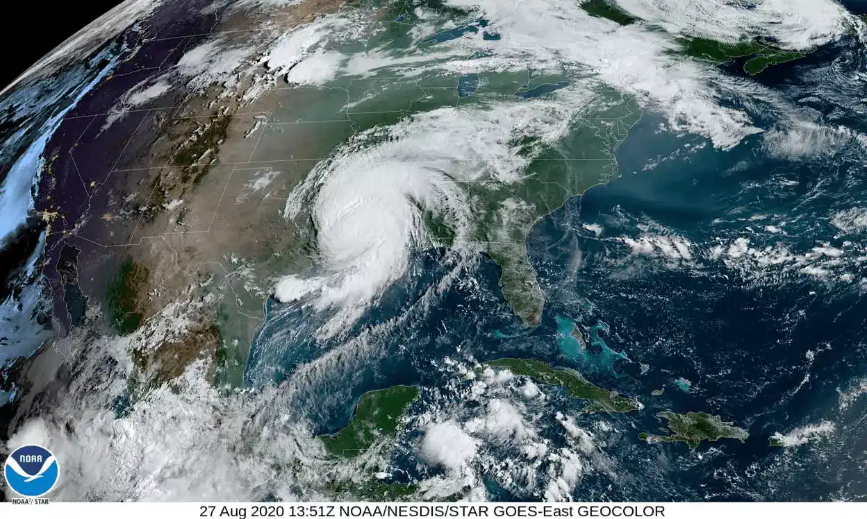
Hurricane Laura made landfall early Thursday morning near Cameron, LA as category 4 storm. It has been downgraded to category 2 and is moving inland with high winds and heavy rainfall and the risk of flash flooding.
At the time of landfall, Laura was a ferocious looking hurricane with a clear circular eye, an intense eyewall, and tightly-coiled surrounding spiral bands.
NHC Hurricane Laura Forecast Discussion, Thursday, August 27, 2020
Hurricane Laura is forecast to continue weakening as it moves inland, and will become a tropical storm later today. Significant rain and wind gusts are expected across portions of Louisiana and Arkansas this evening.
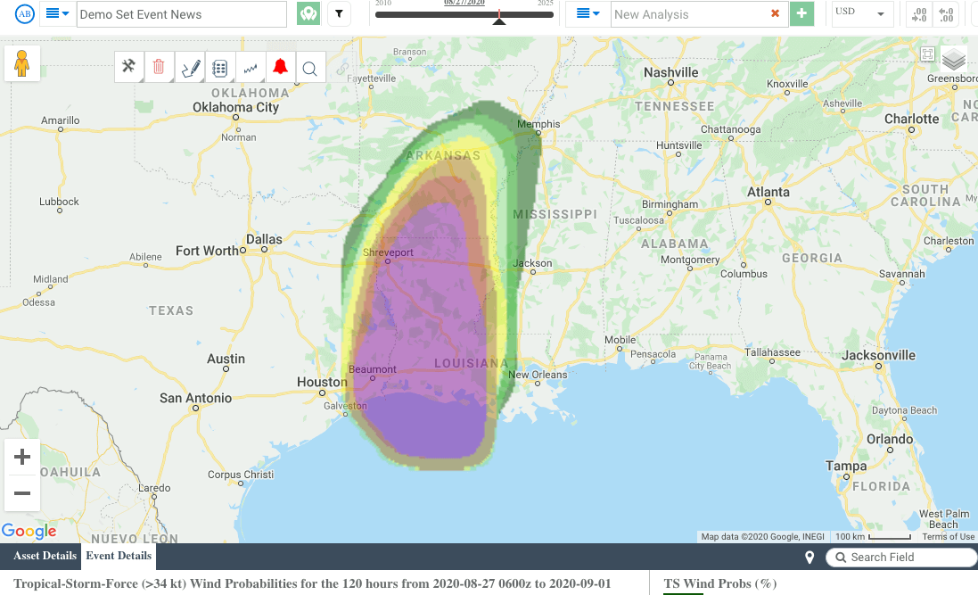
In addition to wind probabilities and forecast wind swaths, storm surge potential outlooks, precipitation-based flood potential outlooks and excessive rainfall outlooks are available in EigenPrism, giving you a complete picture of how Hurricane Laura may impact insured locations.
Key quick links are shown below, and a template Impact Summary report has been created.
Assess the impact in EigenPrism:
Quick Links:
- Tropical storm force wind probabilities – as of August 27, 2020
- Hurricane Laura forecast wind swath – Advisory 30A, August 27, 2020
- Hurricane Laura 5-day past max winds – as of August 27, 2020
Impact Summary Report:
An impact summary template report is now available; SAMPLE Laura 2020 Impact Summary. EigenPrism users can copy the template report and apply it to their own exposure:
- Open the impact summary report (see link above)
- or, search for the “SAMPLE storm name Impact Summary” on the EigenPrism home page
- then click Manage > Copy to select your workspace and save with your own exposure
Please note, as report templates are frequently updated, you can refresh the report by changing the Analysis Date. See instructions here.
Don’t have access to EigenPrism?
Sign up for a trial account and access full impact reports of all events. Contact us and we’ll set up a trial account for you.


