

Hurricane Laura
Hurricane Laura, now a category 4 storm, is bringing potentially catastrophic storm surge to the Texas-Louisiana coast, where it is expected to make landfall tonight. The storm surge will arrive in advance of the storm.
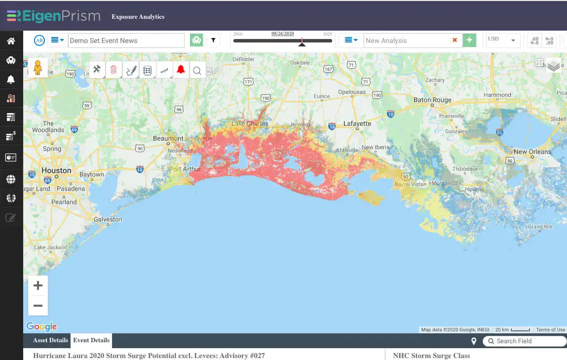
Unsurvivable storm surge with large and destructive waves will cause catastrophic damage from Sea Rim State Park, Texas, to Intracoastal City, Louisiana, including Calcasieu and Sabine Lakes. This surge could penetrate up to 30 miles inland from the immediate coastline.
National Hurricane Center – Hurricane Laura Forecast Discussion, Wednesday August 26, 2020
After landfall, Hurricane Laura is expected to weaken but will bring damaging winds and precipitation inland over western Louisiana and eastern Texas, then turn northeastward.
In addition to wind probabilities and forecast wind swaths, storm surge potential outlooks, precipitation-based flood potential outlooks and excessive rainfall outlooks are available in EigenPrism, giving you a complete picture of how Hurricane Laura may impact insured locations.
Key quick links are shown below, and a template Impact Summary report has been created.
Assess the impact in EigenPrism:
Quick Links:
- Hurricane force wind probabilities – as of August 26, 2020
- Tropical storm force wind probabilities – as of August 26, 2020
- Hurricane Laura forecast wind swath – Advisory 27A, August 26, 2020
- Hurricane Laura 5-day forecast max winds – as of August 26, 2020
- Hurricane Laura 2020 storm surge potential outlook – Advisory 27, as of August 26, 2020
Impact Summary Report:
An impact summary template report is now available; SAMPLE Laura 2020 Impact Summary. EigenPrism users can copy the template report and apply it to their own exposure:
- Open the impact summary report (see link above)
- or, search for the “SAMPLE storm name Impact Summary” on the EigenPrism home page
- then click Manage > Copy to select your workspace and save with your own exposure
Please note, as report templates are frequently updated, you can refresh the report by changing the Analysis Date. See instructions here.
Don’t have access to EigenPrism?
Sign up for a trial account and access full impact reports of all events. Contact us and we’ll set up a trial account for you.


