

Landslide in California washes out section of Highway 1
A major landslide in California has completely washed out a section of Highway 1, near the Dolan Fire burn scar in Big Sur. Heavy rain from last week’s winter storm caused the landslide and debris flow.
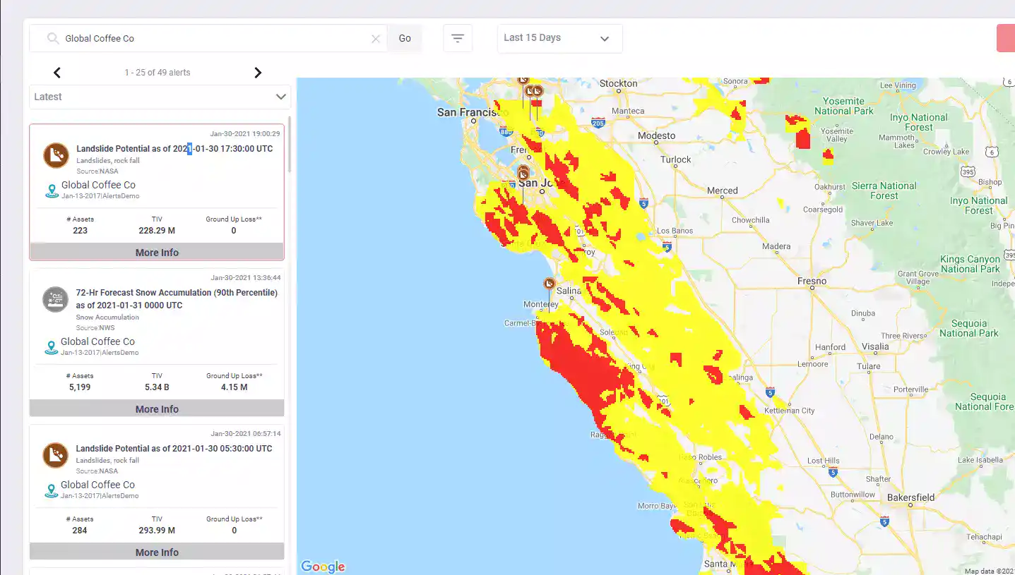
The image above, from NASA’s global Landslide Hazard Assessment for Situational Awareness (LHASA) model, shows that the landslide potential for coastal California remains high, as of January 31, 2021.
The LHASA model offers a way to assess landslide potential in real-time:
- The model compares precipitation data from the last seven days to the long-term precipitation record, together with the susceptibility of the terrain.
- Terrain factors include whether roads have built, if trees have been cut down or burned, location of major tectonic faults, strength/weakness of local bedrock and steepness of hillsides.
In EigenPrism, LHASA potential maps can be accessed in the real-time event catalog. The daily maps provide LHASA Global Landslide Potential ranked by hazard level (no hazard, moderate hazard, high hazard). Users can set alerts to be notified whenever an asset is within a landslide potential hazard zone.
Assessing the impact
EigenPrism users can follow this quick link to immediately overlay today’s landslide potential map on their exposure: Global Landslide Potential as of January 31, 2021.
EigenAlerts provide automated notifications via email and text message with key metrics to estimate impact:
- Customized and mobile-enabled.
- Updated as forecasts and advisories change.
Don’t have access to EigenPrism?
Sign up for a trial account and access full impact reports of all events. Contact us and we’ll set up a trial account for you.


